Friday, August 16, 2013

Village Greens North Mountain Bike Park, Greenwood Village, CO

Village Greens was a fun find that's near Cherry Creek Reservoir on the South-East side of Denver. I've seen the mountain bike park up in Boulder (Valmont Bike Park) and was happy to see that another was brought down to the south end of town.

The Village Greens park is what I would consider a skills park. There's virtually nowhere to get "air", but plenty of stuff to get hurt on. The trails here are a trail system broken up into Green, Blue, and Black runs. For the most part I would consider the grading appropriate. One of the nice things about this park, is that there is an alternate route to every obstacle available, so there's no worry about getting thrown into something you're not prepared for (apart from a couple of fairly steep sections).

I wouldn't go here if you're looking for a long distance cardio workout as there are only about 2.5 miles of trail, and spending more than an hour here would be tough. For a good local ride, with some nice challenges, and an excuse to test out and improve your skills this place is well done.

As a solo ride I didn't stop for many pictures but did webcam most of the trails. The trails are one-way, so follow the signs.

Getting There:

The parking lot can be found here: 39.63659, -104.87765

I imagine weekends will be crowded here, so while there is ample parking, it may fill quickly. There's a porta-potty off the main road into the Park area, but I would advise coming already dressed to roll.


Trailhead:

Head to the left of the two signs that you see in the pictures above onto the main gravel road. After a very short jaunt keep an eye out on the left for the singletrack. There's a beginner loop that's pretty basic which will take you back to the spot you're in. After that take the sames singletrack back and enjoy yourself. 


Trail Stats:

Not too many to speak of for this trail. I did fall once, does that count?


Sunday, August 11, 2013

Waterton Canyon, Littleton, CO

Waterton Canyon is a bit of a mixed bag. There's significant time spent on a fire road getting up to the real meat of the ride, which, depending on your perspective, can be a good or a bad thing. If you power up the first 6 miles keeping in mind that this can be a fantastic warm up, and keep your eyes out for critters (I've seen bighorn sheep, rattlesnakes, and a bear) this can be a good after work or in town ride. The trail winds it's way along with the South Platte River so you'll also see plenty of fishers and just generally nice views in the canyon.

I consider this a very easy ride for the first and last 6.5 miles. The middle third I'd consider intermediate, mostly due to climbing.


Getting There:

The trial head can be found here: 39.491304, -105.093437

There is typically plenty of parking to be had in this area, as long as you don't sleep in too long. I've gotten there as late as 9 or 10 and haven't had any issues, even on a Saturday. Along with a fair amount of parking you'll find porta-potties. There is another adjacent parking lot, but I'm not sure if there are any restrictions, or if this is a true overflow lot.

Trail Head:


The trail head can be found across the street to the West (follow the crosswalk across Waterton Road). It's pretty tough to miss. This will take you on a short dirt path which will in turn take you to the fire road that leads up the trail.

The Ride:

0.0 You're on the fire road. You can't make any turns, just follow the river and enjoy the views. Watch out for LOTS of hikers, runners, bikers, etc. No dogs are allowed here, so it is one less thing to worry about. Kids are very common as well, so give 'em plenty of room. There's enough room on the trail that you shouldn't have too worry about slowing down overly often.


6.0 You've made it to the damn. Prepare for the slog going up a steeper section of fire road. Again, no turns to miss here until the very top. At that point you'll have the option of following more fire road - but the road is clearly marked as private. On the left you'll see the beginning of the Colorado Trail. Begin the fun part of the ride.


6.8 After a short and somewhat loose climb you'll reach a bench which marks the beginning of the switchback trail. The switchbacks are manageable, all but the last one which turns you then throws some rocks in your way. It's doable, but takes a bit of focus. Don't forget your legs.

7.8 Lenny's rest. Take a moment to grab a snack, pop a salt tab, and read the inscription on the bench. Pay attention here, you'll want to follow signs towards Roxborough/Indian Creek. This is on the left side as you finish the switchbacks. If you continue straight you'll stay on the Colorado Trail - no telling where you'll end up. There are some fairly short intense climbs that remain. Keep geared low for the next half mile.


8.2 If you continue straight, you'll find yourself heading back to the Inidan Creen Trailhead. Hang a left (toward Roxborough). If you've done the Indian Creek trail before this should be familiar, although in revers. There are some fun little descents and a few technical bits, mostly involving trees.


9.5 (approx) you'll come to another intersection. Hang a left back to Waterton Canyon. This will be marked with a sign and a map. You'll find yourself going on the most fun downhill portion of the entire ride. Keep on your toes and beware the final tree. You can ride down the tree both on the left and right side - in my opinion the left proves to take more skill and choosing your line, while going right takes more cojones.


11 (approx) Back at Waterton - head down (North) and make your way back to the car.

Trail Stats: 17.28 Miles
Max Elevation: 6600 ft
Min Elevation: 5500 ft
Time to Beat: 1h42m


Tuesday, May 28, 2013

Indian Creek Big Loop, Sedalia, CO

Indian Creek is probably one of my favorite rides in the area, at least for the first 10 miles. The last few miles are always a chore, but worth the pain.

This would be a decently long trail run as well, with 100% packed trail, covering fire road, double track, and single track. I've considered doing this as a run, but doing the ride just seems like way more fun.

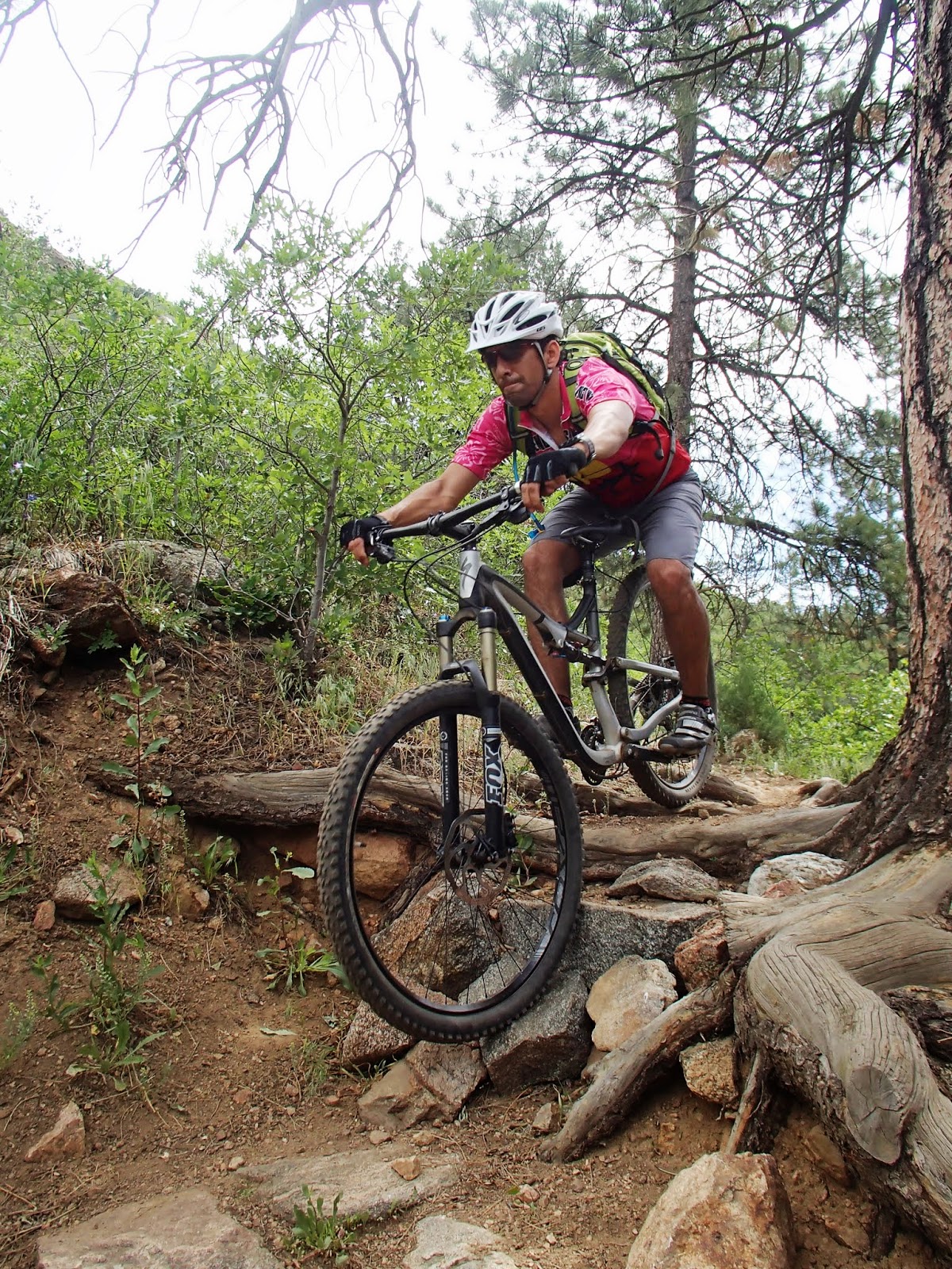
(Preparing for battle)


Getting There:

You can use these coordinates to find the trail head: 39.37904, -105.09973

There's not a whole lot to be found at the trail head. There's a large pit style toilet, and rumor has it there's running water around the same area, but I would be prepared to bring in everything you need. There's also horse camping here (stables and all) as well as tent/trailer camping. We've stayed here before to camp, and it's a nice enough area, but not very many spots are available. Come early if you plan to stay.


(parking lot)


On the way to the ride you'll likely pass through the little town of Sedalia, there's an ice cream shop there if you need to wet your whistle before, or more likely, after your ride.

Parking in this area comes at a cost of $6/day and they accept cash or check. You can park up the road a bit for free, but it's a small price to pay to be able to use a toilet, and support your local wilderness.

Trail Head:

You can find the trail head just across from the pit toilet. This will be labeled as the 800 trial. Keep that in mind, when all else fails follow signs to the 800 trial. There is a decent amount of parking, but horse trailers and sunny days can pack things up a bit. I've never had a problem finding a place to park.

The Ride:

(In Miles)

0.0 Get started across from the pit toilet. The first bit throws you right in with some low gear climbing. You likely won't die here, but you will breathe heavily. This area is what single track should all be like. Smooth, flowy, and climbs here and there. Watch out for fallen trees, especially after storms.

(trail head)

(a sustained climb on the way up)

(keep chugging)

(don't forget to breathe)


1.5 You'll reach a clearing where several trail options will present themselves. As mentioned previously, stay on the 800 trail (left) towards the fire road. There is a single track trail you can take here as well (towards the right/straight) that will take you all the way into Roxborough, with some beefy climbing on the way back up. Be sure to stop for a drink and a picture, the view to the south is great.

 (enjoy the view)


(follow signs for the 800 trail)

(descend down fire road. watch for horses)


Descend the long fire road. Watch out for horseback riders. They don't travel quite as quickly as us bikers and are easy to spook.

3.6 Prepare for a short brutal climb, with a couple of water bars for a moment of ease. If you're about to vomit it means you've gone the right direction.

4.3 You'll move from double track back to single track. Follow the sign for the Indian Creek trial. There are also some power lines here that act as a good trail marker. After this point you'll descend into some more pristine single track with quite a few switchbacks. Hold on and enjoy.


(descend through more fun single track)


5.4 You'll hit an intersection, go left/downhill. This is a fun section for about a mile (give or take), you'll have to do virtually zero pedaling, and will hit a number of small roller jumps. It's easy to get carried too far on these if you're not ready for them, but this is one of the highlights of the ride in my opinion.

6.4 Continue following signs towards Waterton/Colorado Trail.


You'll run into the Fields of Elysium after the Roxsborough section. I've named these myself as this is what heaven must look like if you eat it on your mountain bike.


After this things get tough as you begin the slog back up the mountain from whence you came. Be sure to eat and drink plenty, you've got a lot of climbing to do.

At about 8.2 miles you'll have the option to head to Waterton, or follow the Colorado trail. I would consider this a bailout point to Waterton, you'll end up on the other side of the mountain, but at the Waterton trail head which is well traveled. If you're hurt, hungry, or otherwise this will likely be easier to get to than back to the trailhead you started from.


9.6 Don't feel bad if you have to walk, and if you don't have to, you are a beast.


10.3 Keep following signs to the 800 trail. You'll hit a Y in the trail around here. To the left follows the 800 trail (this is marked), to the right will take you back to Waterton via a different path.

After another series of climbs you'll end up adjacent to Bear Creek. This is a refreshing way to cool off and lets you know you're going the right direction. You'll cross the creek a couple of times on your way back up the mountain.


13.0 The climb is nearly over. You'll climb up relatively smooth single track to get back to the equestrian camping area, after that you only have about 1/3 of a mile back to the car. The site of horse trailers here is blissful relief.


This is a great ride overall, but not for the novice. You need some conditioning, some middle level handling skills. Don't be fooled by the distance, this can be a loooong ride if you're not prepared. Make sure you've got a full bladder (3L for me, and I ran out with about a mile to go), food, and plenty of daylight. While I've done this on my own, I'm not sure I'd recommend it, there are times where there is very little traffic to save your behind if you get in trouble. On that note, be as nice as you can to the horseback riders out there, they're the ones who will save you if you break your butt on the trail.

Trail Stats:

14.3 Miles
2370 feet of climbing

Time to Beat:

3h26


Monday, April 15, 2013

Millcreek Canyon, Salt Lake City, UT

I did Millcreek as a trail run. There had been a light rain the night before, but the trail was nearly 100% dry, with just a couple of puddles to hop, nothing major at all.

Getting There:

The trail head can be found here: 40.691410, -111.769079 off of Interstate 215. 

There's a fee station about 1/2 mile up Mill Creek road. Oddly, you pay on your way out, $3.00. 
The fee station was closed on my visit and there didn't appear to be a place to leave your money - so a free ride.

There appeared to be a fair amount of parking and also street parking across from the lot. There were no bathrooms visible. So be sure to relive yourself before going or be prepared to become one with nature. Be sure to go off trail if you do.

Parking area


View up the trail from parking area


Map of area


The Run:

This is a lung buster from the start. If I had to do it again I might run up the road and back a couple of times to prevent a heart attack.

Mile 0: Head towards the informational sign. You'll start on a crushed gravel trail. This is fairly painful on the feet if you're going minimalist for your shoes. Vibrams would be a no go, and the Minimus I was in had me wishing this were a hike, not a run.

Trail is very rocky, there are some softer bits on the sides of the rocky sections.


GPS signal in the canyon was a bit spotty, so some distances may be off slightly.


Mile 0.7: You'll have gone up a few switchbacks which only seem to get steeper. At this point there is a very faded sign which directs you towards a lookout point, which I followed. You have to squint that it tells you to head left (I believe at this point you're on the Pipeline Trail). There appear to be plenty of other trials out here, so getting a run of some distance in shouldn't be a problem.

I took a left at this sign.


Mile 1.6: You'll have continued on a mix of soft single track which is more or less level, and foot crushing spiky rocks from the depths of Hell. There's a payoff in the great view of the Great Salt Lake, the City, and everything within about 50 miles. Not too shabby.

You'll be rewarded with some stunning views at the lookout.


I continued to head up the hill which appears to ascend straight into the stratosphere (hence the odd looking elevation chart). This was more of a walk/hike than anything else until the turnaround.


Mile 1.8: Turned around, but there seemed to be plenty of trail left if you feel like getting more of a work out in. My time was limited by someone I was with, so 25 minutes out, and 25 back, give or take.

Mile 3.5: Back to car.

Stats:

This was a slow run, with 3.55 miles covered in 48 minutes, for a pace somewhere around 13 minute miles. The way back was fairly quick, but calling the way up a "run" is being generous. I'm not sure I would do this run again with the shoes. And from a mountain biking perspective it wasn't technical in any way - so that may  be good or bad for you.

Elevation Profile

Overview map