I consider this a very easy ride for the first and last 6.5 miles. The middle third I'd consider intermediate, mostly due to climbing.


Getting There:
The trial head can be found here: 39.491304, -105.093437
There is typically plenty of parking to be had in this area, as long as you don't sleep in too long. I've gotten there as late as 9 or 10 and haven't had any issues, even on a Saturday. Along with a fair amount of parking you'll find porta-potties. There is another adjacent parking lot, but I'm not sure if there are any restrictions, or if this is a true overflow lot.
Trail Head:

The trail head can be found across the street to the West (follow the crosswalk across Waterton Road). It's pretty tough to miss. This will take you on a short dirt path which will in turn take you to the fire road that leads up the trail.
The Ride:
0.0 You're on the fire road. You can't make any turns, just follow the river and enjoy the views. Watch out for LOTS of hikers, runners, bikers, etc. No dogs are allowed here, so it is one less thing to worry about. Kids are very common as well, so give 'em plenty of room. There's enough room on the trail that you shouldn't have too worry about slowing down overly often.

6.0 You've made it to the damn. Prepare for the slog going up a steeper section of fire road. Again, no turns to miss here until the very top. At that point you'll have the option of following more fire road - but the road is clearly marked as private. On the left you'll see the beginning of the Colorado Trail. Begin the fun part of the ride.


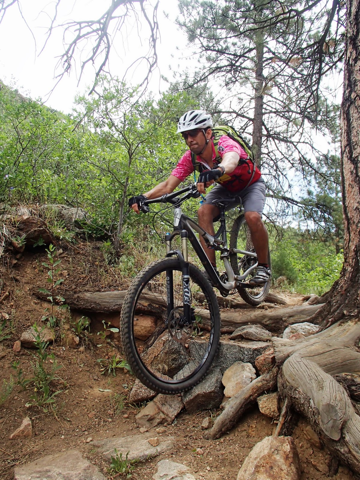
6.8 After a short and somewhat loose climb you'll reach a bench which marks the beginning of the switchback trail. The switchbacks are manageable, all but the last one which turns you then throws some rocks in your way. It's doable, but takes a bit of focus. Don't forget your legs.


7.8 Lenny's rest. Take a moment to grab a snack, pop a salt tab, and read the inscription on the bench. Pay attention here, you'll want to follow signs towards Roxborough/Indian Creek. This is on the left side as you finish the switchbacks. If you continue straight you'll stay on the Colorado Trail - no telling where you'll end up. There are some fairly short intense climbs that remain. Keep geared low for the next half mile.


8.2 If you continue straight, you'll find yourself heading back to the Inidan Creen Trailhead. Hang a left (toward Roxborough). If you've done the Indian Creek trail before this should be familiar, although in revers. There are some fun little descents and a few technical bits, mostly involving trees.

9.5 (approx) you'll come to another intersection. Hang a left back to Waterton Canyon. This will be marked with a sign and a map. You'll find yourself going on the most fun downhill portion of the entire ride. Keep on your toes and beware the final tree. You can ride down the tree both on the left and right side - in my opinion the left proves to take more skill and choosing your line, while going right takes more cojones.
11 (approx) Back at Waterton - head down (North) and make your way back to the car.
Trail Stats: 17.28 Miles
Max Elevation: 6600 ft
Min Elevation: 5500 ft
Time to Beat: 1h42m


No comments:
Post a Comment