Monday, April 15, 2013

Millcreek Canyon, Salt Lake City, UT

I did Millcreek as a trail run. There had been a light rain the night before, but the trail was nearly 100% dry, with just a couple of puddles to hop, nothing major at all.

Getting There:

The trail head can be found here: 40.691410, -111.769079 off of Interstate 215. 

There's a fee station about 1/2 mile up Mill Creek road. Oddly, you pay on your way out, $3.00. 
The fee station was closed on my visit and there didn't appear to be a place to leave your money - so a free ride.

There appeared to be a fair amount of parking and also street parking across from the lot. There were no bathrooms visible. So be sure to relive yourself before going or be prepared to become one with nature. Be sure to go off trail if you do.

Parking area


View up the trail from parking area


Map of area


The Run:

This is a lung buster from the start. If I had to do it again I might run up the road and back a couple of times to prevent a heart attack.

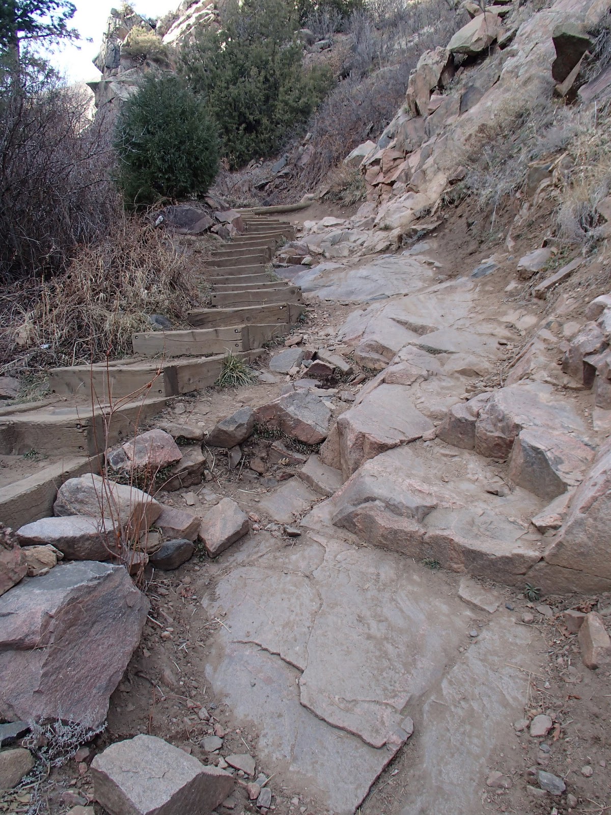
Mile 0: Head towards the informational sign. You'll start on a crushed gravel trail. This is fairly painful on the feet if you're going minimalist for your shoes. Vibrams would be a no go, and the Minimus I was in had me wishing this were a hike, not a run.

Trail is very rocky, there are some softer bits on the sides of the rocky sections.


GPS signal in the canyon was a bit spotty, so some distances may be off slightly.


Mile 0.7: You'll have gone up a few switchbacks which only seem to get steeper. At this point there is a very faded sign which directs you towards a lookout point, which I followed. You have to squint that it tells you to head left (I believe at this point you're on the Pipeline Trail). There appear to be plenty of other trials out here, so getting a run of some distance in shouldn't be a problem.

I took a left at this sign.


Mile 1.6: You'll have continued on a mix of soft single track which is more or less level, and foot crushing spiky rocks from the depths of Hell. There's a payoff in the great view of the Great Salt Lake, the City, and everything within about 50 miles. Not too shabby.

You'll be rewarded with some stunning views at the lookout.


I continued to head up the hill which appears to ascend straight into the stratosphere (hence the odd looking elevation chart). This was more of a walk/hike than anything else until the turnaround.


Mile 1.8: Turned around, but there seemed to be plenty of trail left if you feel like getting more of a work out in. My time was limited by someone I was with, so 25 minutes out, and 25 back, give or take.

Mile 3.5: Back to car.

Stats:

This was a slow run, with 3.55 miles covered in 48 minutes, for a pace somewhere around 13 minute miles. The way back was fairly quick, but calling the way up a "run" is being generous. I'm not sure I would do this run again with the shoes. And from a mountain biking perspective it wasn't technical in any way - so that may  be good or bad for you.

Elevation Profile

Overview map

Tuesday, April 9, 2013

A Note On Trail Etiquette

Don't be a jerk.

I mean, respect others on the trail with you.

Mountain bikers, trail runners, and horses all seem to enjoy the same trails, at the same time, and often times it seems timing dictates that all three of us will run into each other at the same time in a great confluence of sweat, stink, and fun.

Generally speaking bikers yield to hikers, and hikers yield to horses. Through the commutative property bikers must also yield to horses, in addition to snakes, skunks, and rabid dogs. Bikers tend to be the fastest folks on the trail, and this is probably part of the reason for this order; additionally, bikers can do a lot of damage at speed with both their bodies and their bikes. A follow up to this rule is that uphillers have preference over downhillers.

With all that being said, remember that you're out on the trail to have a good time, and maybe get a workout in. While those horseback riders look like they're living on easy street, sitting high and mighty on their horses, and crapping all over the trail, I assure you they do far more good than bad. If you've ever lived somewhere where a storm ravages a trail, thank the riders for clearing logs, debris, and bodies out of the way. Also, when you break your leg taking that drop you should have thought twice about, guess who's going to come to your rescue?

So, in an effort to be friendly I advise the following:

Bikers: Stop for horses. Ask the riders if they'd like to go by. More often than not they'll just wave you by, or will mosey steadily along. Relish your time to rest on the side of the trail, take a swig of water, eat a snack, or wonder aloud if it's possible to throw up your colon out of your mouth.. Try saying something helpful, yet funny, "Hello Mr. Rider, there are two riders behind me that are sucking more wind than I am." As for your interactions with trail runners, they're usually so focused and in so much pain that they'll likely just jump out of the way and pay you no mind, but it's still you're duty to stop for them. Be sure to call how many people are in your group and tell them that they should probably eat a hamburger as they're looking a little wiry.

Runners: Same as bikers, stop for horses, and ask if it's all right to pass. Don't sneak up behind a horse unless you want to be responsible for someone's concussion or get a facefull of hoof. If you want to pet the horse, just ask - rubbing the snout of a horse is like making love to a rainbow. If you encounter a biker try and give 'em a wave - keep in mind they're suffering as much as you are, maybe more (seriously).

Horses: Neigh neigh, humph humph. Ppppbtttt.

Horseback Riders: Let us know if there's hazards on the trail, and remind us that horse poop doesn't really stink that much, so don't sweat it. Tell us we're doing a good job, and compliment our shoes (especially for runners) or on the bike. Be warned; however, if you compliment either of these items you may risk hearing a half hour of us talking about why we're riding/wearing what we are.

Whoever it is, if you encounter someone huffing and puffing coming at you, and they're going uphill, cut them a break and pull of to the side. It may be in your right to take the right away, but use common courtesy as well. Same goes for encountering kids. Generally kids are dumb, it's not their fault, so give them a bit more room and don't barrel by them on foot, on bike, or otherwise.

Lastly, remember why you're out there, which is hopefully to have a good time. You may be looking to get a workout in, but if you're going to put others in danger (I'm looking at you D-Bag in the yellow kit at Hidden Mesa that drives a Green 90s era Chevy) for worry that you're going to let your heart rate drop by 5 beats a minute then you're better off running on the road, biking on the trainer, or getting out there when no one is going to be around. You're giving us all a bad name.

Train safe and have fun.


Monday, April 1, 2013

Hidden Mesa, Franktown, CO


Hidden Mesa Trail is South of Parker and North of Franktown off highway 86. It's a bit of a local gem as it's primarily a trial ride (95%) with a good climb out, a technical bit in the middle that will provide some fun, challenge, and a bit of blood. There's some pretty smooth single track throughout, and the technical bits are short enough to walk through if need be. This trail works well as both a run and a ride. You could likely get away with a hardtail here and not have any issues - but taking advantage of some jumps in the rock garden a full squish never hurts.

Getting There:

You can head to these coordinates to find the trail head 39.40954, -104.76221. There's a large porta potty (see the brown hut in the picture) that can be used for changing if need be. There's no running water, so be sure to bring your own. There are some covered picnic tables, so bring a meal and a beer for after. 

The trail head is about 10 minutes south of Parker.

There's another trial head here: 39.40571, -104.80292 
which will start you off at the top of the mesa and let you avoid most of the climbing. 

Trail Head:

There is a covered area with picnic tables and a large size porta-potty. You can change in there if you like, but I usually take my chances in the car. We did find out that beer is allowed, but it has to be 3.2 and in a can.

The Run:

This is a lollipop loop, with approximately 2 miles to the loop, 2.3 miles around the loop and 2 miles back. We typically run the loop a few times in either direction to keep things mixed up. I'm typically good for about three loops by either running or riding... and then I'm done.

Mile 0: Start off by looking for the dirt trail heading West. It's hard to miss.

Mile 0.5: You'll cross a bridge over Cherry Creek, hang a right (North) at the paved trail. This is the Cherry Creek Trail, you won't be on here for long.

Mile 0.9: Keep an eye out for the sign on the left that will direct you towards the main loop. You'll take a left to get back on dirt. From here you'll have a steady climb to the top of the mesa. The last 0.1 miles of the climb get a bit gnarly, on foot or on bike. It can be done provided it's not too washed out.

Mile 2.3: You've made it to the top. Now it gets fun. You can go either left or right, but I typically go right to start (further up the hill) just to get it out of the way. This also gets you to the rock garden a bit more quickly. This is a great area to work on jumps, hops, navigating drops, etc.

Mile 4.5: Back to the start of the loop. Head back down or take off for another loop or two.

The Trail:

The trail is packed single track mixed with a short bit (<05.mi) of Multi Use Path, and some rocky sections. Everything is run-able, and with little to no coverage out there it dries very quickly after snow and rain. Watch out for your trail brothers and sisters, and remind them to get off the trail if they're doing bike maintenance. Bring water and sunscreen.

Horses are common, as there is a horse lot at the trailhead. Be nice to them, they clear all the crap out of the trails for the rest of us, ironically, they also leave crap on the trails. Practice your bunny hops.

Prairie Dogs can also be a nuisance, and they mock you if you fall.

Trail Stats:

Lollipop, 6.7 miles with one loop up top. Ran it in 1:01, biked it with three loops up top from main trail head in 54 minutes.


Trailhead Parking. I've never run out of room here. 

0.9 Miles in be sure to hang a left to head to the mesa.


Some double track to get you going.

You'll find a cow gate as you're heading up to the loop. 

At the start of the lollipop you'll find some directional and distance markers.

Heading through the rock garden


 Don't be intimidated by the locals

Single track and Pike's Peak

If you're feeling adventurous on the bike there are plenty of places to hurt yourself in the rock garden.

The first two miles out are at about 4%... it gets relatively flat after that.


You start on the East side and head West to begin.


Tuesday, February 19, 2013

Greenland Trail, Larkspur, CO

I first encountered the Greenland Open Space via the Greenland Trail Run Series held every May, they offer various distances from 8 mile up through 50K with some farily speedy folks. Since then I've found it to be a good training area for trail runs, and while I haven't ridden out there, you could get away with a hardtail to put in a few loops.

The convenience of the parking lot and the length of the main loop (8 miles) makes this a good training area, I've put in as many as three loops out here at any given time, using the parking lot as a good place to refill and refuel.

Getting There:

Greenland Open Space is about 40 miles south of metro Denver, so not an all day haul, but you should make some time. Once you get out of town you'll likely not hit any traffic getting around. There aren't any real facilities within about 10 miles of the trailhead, so plan any bowel issues accordingly.

The trailhead can be found here39.18093, -104.85356

There is a ton of parking and I've never seen it crowded. If you haven't changed ahead of time there's a full sized porta potty, but that's about it for facilities. There's some building facades, but they probably won't offer much cover.

The Run:

Hopefully your luck will be better than mine, battling fierce 30mph headwinds for the first three miles on a counter-clockwise loop. 

0 Miles From the parking lot head between the porta potty and the fake buildings and make a hard right (West) followed by a hard left at the "T" in the trail (less than 0.1 miles into the run) to end up parallel to the railroad tracks.

The trail is fairly obvious with no changes in direction for the first 3.4 miles. You'll be on a gradual uphill, but nothing very noticeable.

3.4 miles. When you see the sign (picture below) make a hard left to begin up a winding series of long switchbacks and some steeper climbing (and a few downhills to let your legs loose a bit). There are a couple of branches off the trail, but sticking to the main trail is obvious.

5.1 miles. You'll finally be at the peak of climbing having ascended about 450 feet over the first 5 miles. You'll go down the same amount over the next three, so hang on for a fast finish... just don't kick too soon.

7.1 miles. It should be pretty clear which way you need to go to get back to the car at this "T", but hang a right in case you're too out of it to think straight.

8.0 miles. Depending on your watch, you'll wrap up at almost exactly 8 miles. 

The Trail:

Hitting this in mid-February about 5 days after a light snow was no problem. There was mud here and there (easily avoidable), and at the high/shady points of the run there were some snow patches. The way out is mostly exposed to wind and sun, while the middle few miles offer some respite from both. As a mountain bike ride the only issues would have been in the snowy areas, but they're so few and far between it would have been a non issue.

Stats:

I blame the wind (and early season) for a slow day. 8 miles in 1:17 for a pace of about 9:45. Weather apps showed about 30mph winds on the way out, and a few stops for some pictures. Fastest mile was downhill with the wind at my back at 6:46.

Welcome to Greenland. For all your hardware needs don't come here (fake building)

Pike's Peak in the distance (one of CO many 14ers). The Peak overlooks you for a large portion of your run.

Plenty of parking to be had for cars, trailers, etc. There's also a gated dog park for your furry friends.

This is the extent of the local plumbing. Bring your own water.

Looking south (on the way out). A beautiful day and the trail was clear.

The turn at 3.4 miles out. Don't miss it, who knows where you'll end up.

Keep an eye out for passing coal trains. There's a siding here so it's likely you'll see two. I could have sworn I saw some caves in the hills in the distance as well - keep an eye out.


Looking back from the sign at 3.4 miles (looking North) at the first portion of the trail.

Panorama view after starting up the larger hills (around 4 miles)


More of Pike's Peak in the background.


Around 4.5 miles keep an eye out for this grave marker. Kipps Grave. 

Winding back down after the 5.1 mile mark. Hold your horses, it's gonna get faster.


Only 1.5 miles to go.

Overhead of the run. Counterclockwise loop starting from the top (North side).

Elevation Profile.

Saturday, December 1, 2012

Deer Creek Canyon - Plymouth Loop, Lakewood, CO

Deer Creek Canyon is a great technical ride not too far from the south end of town. It's ease of getting to and remote feel make it an ideal place for a ride. Be prepared, this is a tough ascent. It may not be the steepest ascent, or the longest, but throw in some pretty decent technical bits in the mix and you've got a tough climb to the top.

Getting There:

Getting to the Deer Creek Canyon is a fairly quick trip from anywhere in the Denver metro area. You can find the trail head here: 39.54382, -105.15175

Park in the spacious lot and look for the Plymouth Trail Sign to begin your ride.

The Ride:

You'll climb about 1000 feet over the course of 3.4 miles. After getting through the first quarter mile of the ride you can count on a 1.3 mile climb straight up, with virtually no flat spots. There are a few rock gardens that you'll run into on the way up. Nothing that can be ridden, but if you have a 29er you'll be happy.

In addition to plenty of rock obstacles you'll find a fair amount of water bars, and depending on the time of year, you'll run into numerous land mines (horse poo).

About 1.5 miles in you'll find a fallen stump on the right side of the trail, and on the left a sign for the Plymouth Loop - this is the lollipop portion of the loop, you'll make a hard turn left and continue climibing for a bit further. I'd recommend riding the loop this direction (clockwise) as it ends with a pretty fun downhill bomb with a gentler climb leading up.

About 2.5 miles in you'll run into a series of switchbacks. These have only become more rutted as the season has drawn to a close. I have yet to clear one of these naturally; however, if you're creative you can get over the humps and hop yourself a quarter turn to continue your ride (if you're anal about not putting a foot down).

About 3.4 miles into the ride you'll be blessed by the MTB guide sign... this is the mark of the high point of the trail, and it's downhill the entire way from here, save for the last uphill section with 1/4 mile left to go. Lower your seat, hold on, and prepare to catch a bit of air on the water bars down the first main section.

The Trail:

This place can get pretty crowded on a weekend day, particularly if the weather isn't too cold or too hot. Be sure to announce yourself to hikers and bikers alike. As always, be a good trail steward and don't be a douchebag... even if someone deserves it (I'm looking at you dude walking his dog while on his cell phone not paying attention).

The trail was about 99% clear, with one ice patch near the high point of the climb, but with a clear section next to it.

Stats:

5.6 miles in 1h51m. A pretty rough off season ride.

The bathrooms at Deer Creek are some of the nicest in the area. Plenty of room to change, real plumbing, and real toilets. Later in the season these will probably be closed.

Park entry information. If you take a map, put it back unless you plan on taking it home and framing it.

This place can get crowded on a nice weekend day. Watch out for trail runners, hikers, other bikers, and dogs.

When beginning the ride look for the Plymouth Creek Trail sign.

You'll see your fair share of rock gardens on the way up (and down).

"The Stairs". Many a blood and testicle have been lost going down this. A bit of a right of passage to clear the entire section... now, can you make it up?

If you squint you can see the Plymouth  Creek sign on the left, this is where you begin the lollipop. You can see the fallen stump on the right. You can ride up the backside of this on your way down - don't get too crazy with air over the top though, there's a tree that will humble you.

The views on the lollipop are spectacular. You can see all the way to downtown Denver in the background.

One of the many switchbacks on the way up. The approaches are pretty abrupt, and you can see that they're not well maintained.

You've reached the high point of the climb.

Elevation profile

Overview map of the ride.


Below is a map view of the two loops. I've done this with the Plymouth Loop (described above) first, followed by the Red Mesa loop. Once you finish the big descent on Plymouth, hang a left at the fork and head up Red Mesa for more climbing. I did this in the clockwise direction. There's not really a place to get lost here, just stick to the main trail, and hold on for dear life on the way down.


Stats for the two loop ride:

Distance: 9.17 miles
Climb: 1719 feet
Time to beat: 1:46